April 09, 2007

Southwest Utah, Summary

I took a week long photo vacation in southwest Utah, focusing primarily on Zion National Park. The scenery in Zion was much more varied than I expected, and when the weather cooperated, I had plenty of subjects to shoot.

There were mountains...

Court of the Patriarchs, SunriseCourt of the PatriarchsIsaac and Abraham Peaks, Sunrise
The Great White ThroneStreaked WallThe Sentinel
Angels Rest


And canyons...

Shallow CanyonCanyon Wall and PoolCanyon Wall and Pool


And rock patterns and formations...

Pine Tree and Cliff FaceStriated Rock and ShrubRock Patterns and ShrubArch and Dead Tree
Ridge and CottonwoodArch and Cottonwood


And silhouettes...

Silhouette on Cathedral MountainThe Pulpit SilhouetteObservation Point Silhouette


And even water...

The Watchman and Virgin RiverVirgin RiverCascade on Virgin RiverArch, Rocks and Pool
Rocks and PoolUpper Emerald Pool


But I didn't spend all my time in Zion. I ventured into Grand Staircase-Escalante National Monument as well...

Weathered Cliff Face and PlantWeathered Cliff Face and PlantUnnamed CanyonStriated Rock and Boulders


And I particuarly enjoyed the Paria Homesite area...

Mesa and Hills at PariaMesa and Hills at PariaRock Formation and Hills at PariaMesa and Hills at Paria


But my favorite part of the entire trip was the storm breaking at Kolob Canyons...

Nagunt MesaNagunt Mesa ValleyShuntavi Point
Shuntavi Point and Stapley PointTimber Top MountainTimber Top Mountain and Shuntavi Point
Shuntavi PointCanyon on South Fork Taylor Creek


A detailed account of my trip is available here:
Part 1 / Part 2 / Part 3

April 01, 2007

Southwest Utah, Part 1

I originally planned a trip to Death Valley/Mojave in California. I needed to get away for a while, and week's worth of photography was just the medicine I needed, but I just couldn't get excited about it. It seemed a good time to visit the desert, before the temperature got too hot, and maybe with some early season blooms. After a little research, I switched to southwest Utah, specifically Zion and Bryce National Parks. I'd only spent cursory time in Utah, mostly before I was into photography, so the whole area is pretty unexplored. On seeing the week was the last before shuttle service is enforced in Zion, I knew it was the right destination.

Day 1 (Friday): Travel

This was a bonus day, as I wasn't expecting to leave until the Saturday. I managed to squeeze out of work early enough to hit the road and make some significant distance. I tried to make it to Boise, I decided not to risk any farther than Ontario on the Oregon/Idaho border because of the time change and late hour.

I am always amazed at the beauty of south-central Washington. The rolling hills look as if they're covered in cloth, and this time of year the golden grass is absolutely beautiful. I did manage to make it across Oregon without stopping for gas. Silly laws like forbidding me from pumping my own gas means I take my dollars elsewhere.

Day 2 (Saturday): Arrival

I spent most of the day driving across Idaho and Utah, and while 75 mph speeds are nice, it was still a long day. Other than the Salt lake City and Provo area, which seems to gop on forever, there's not much out there. Stopping for gas at some of the small towns gave me flashbacks to my rural Texas days.

I changed plans along the way, deciding to head for Hurricane instead of Cedar City. It's about 40 miles farther south, but also near the entrance to Zion. After studying the maps and realizing the scale of Utah, I thought I would be better off focusing on Zion and hitting other places as time ad weather allowed, rather than dividing my time between two different destinations and spreading myself too thin. I could aim for Bryce next time if I didn't make it.

I arrived in Hurricane that afternoon and got my room for the week with time to spare for an evening scouting trip into Zion. I was amazed at the scenery, but was just as amazed at the crowds. It was Saturday evening, of course, and I'd managed to time my trip during the peak of the regional high school and college spring breaks, so crowds were something I would probably have to deal with the whole week.

I had just enough time to drive along the main canyon road and mentally mark a spot for the next morning's photos, so the scouting run was a success. My shooting would officially start then.

Day 3 (Sunday): Falling In Love With Grand Staircase

Court of the Patriarchs, Sunrise 
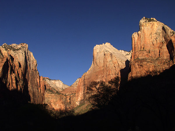
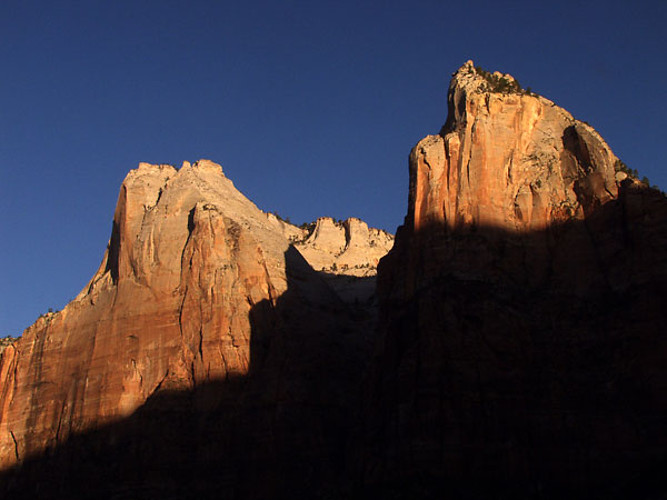
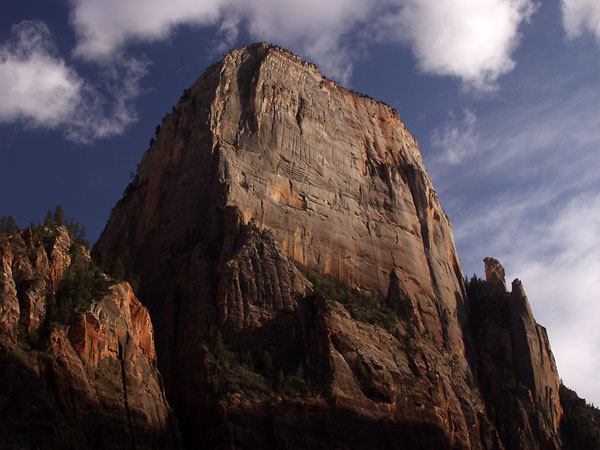
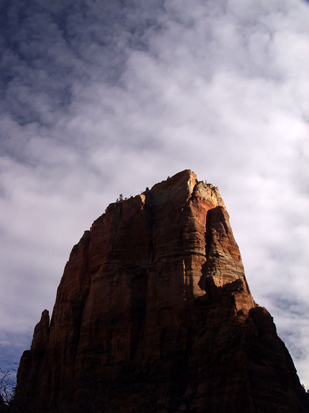
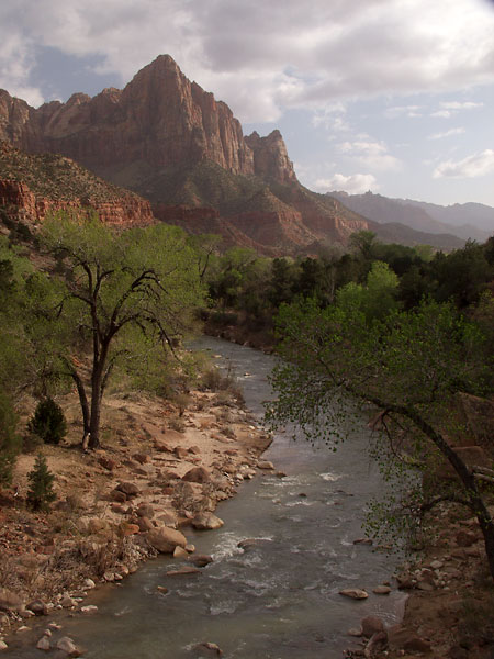
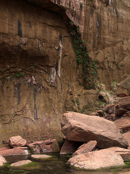
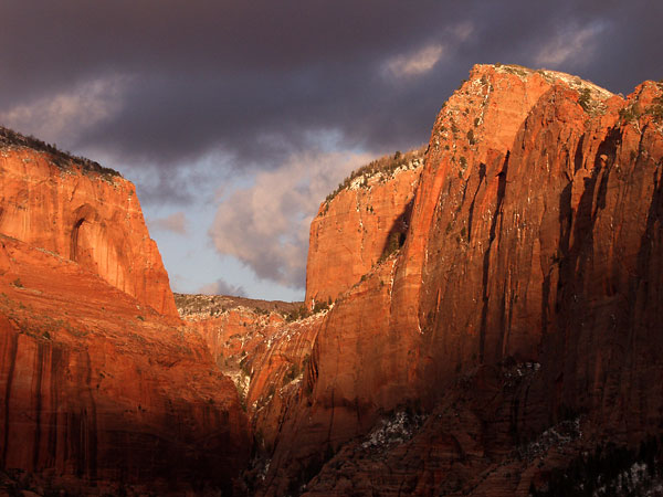
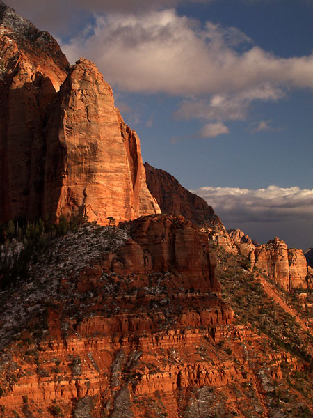
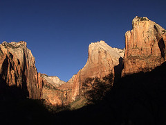
Up at 5:30 for a dawn trek into the park for sunrise. I changed destination at the last minute and headed for Court of the Patriarchs instead of the Streaked Wall. I started shooting as the sun crested the canyon wall behind me, illumiating the peaks of the Court, and spent the next hour at various points there as the line of sun slowly moved down the mountain faces.

Court of the PatriarchsIsaac and Abraham Peaks, Sunrise


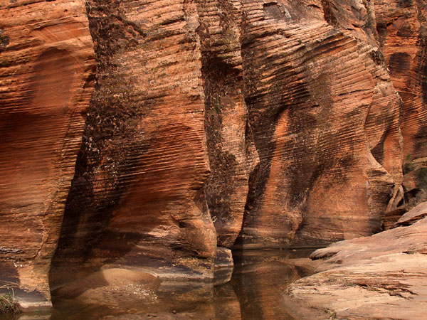
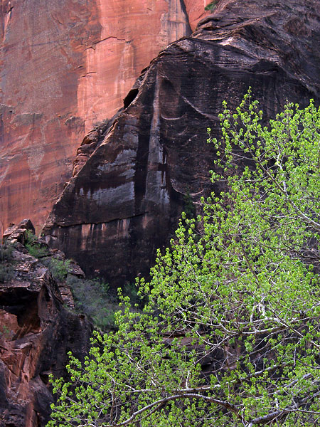
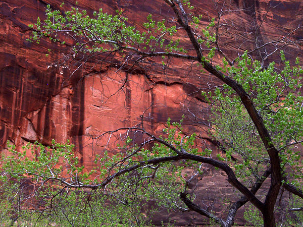
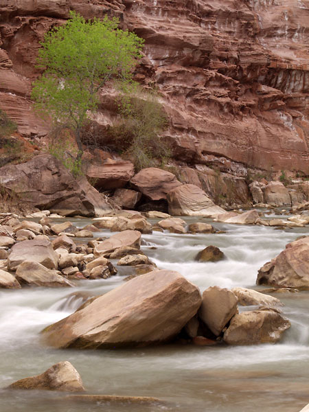
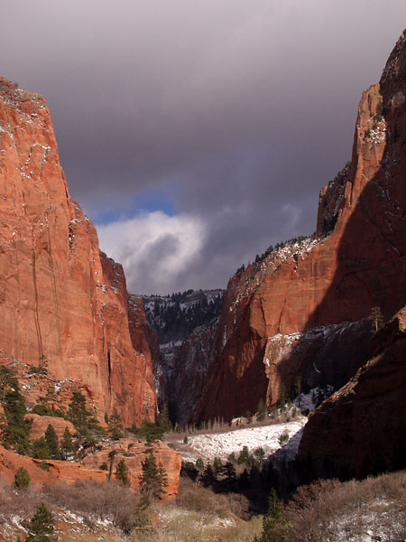
After I felt I'd captured the scene, I moved farther along the canyon road, scouting and learning the area. The light was still good for the most part, so I tried a few more photos, but I quickly realized that shooting in the canyon can be difficult. I didn't have a wide enough lens to capture some of the shots I wanted. Shooting up and down the canyon is possible when the light is right and the sun is high enough, but for the most part I had to think more abstractly in the canyon. Even then, I found that I didn't always have enough zoom to get exactly the composition I wanted.

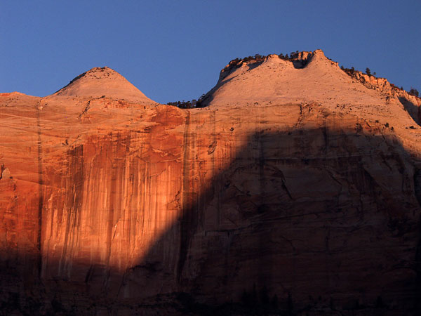
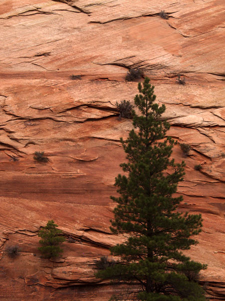
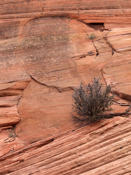
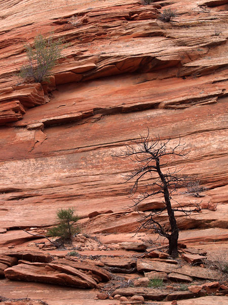
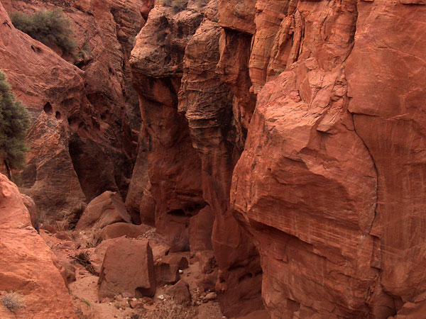
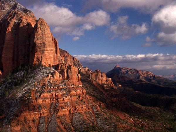
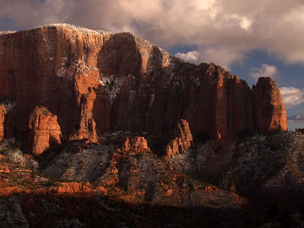
As the good light faded, the weekend crowds arrived, and I headed out of the park for midday to seek solitude in exploration. I drove east through the tunnel into upper Zion and got my first look at the interesting formations and strata patterns. But here too the crowds were forming, so I continued out of the park toward Grand Staircase-Escalante National Monument.

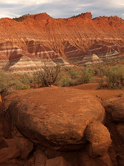
At the very least I wanted to see the Vermillion Cliffs laballed on my road map. They were interesting, but pretty far from the road. I didn't have much of a map for Grand Staircase -- just a Utah gazeteer -- so wasn't sure if the roads to them were public or private. To be safe, I stayed on the main road. I knew very little about Grand Staircase, so I was going on whim. The nearest destination was Paria Homesite. That sounded pretty intersting since I like ghost towns, so I decided to check it out. It turned out to be a pretty good idea.

Paria (also spelled Pahreah) was an old settlement from the 1800s that was long abandoned. It also served as a movie location in starting the 1930s, and was even used for filming part of The Outlaw Josey Wales. Floods had taken care of the old buildsings, and vandals had lovingly burned the movie set to the ground last year, so all that was left were charred foundations.

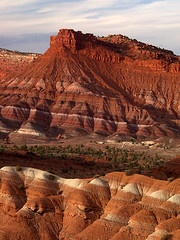
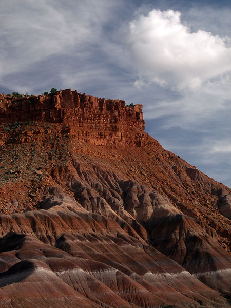
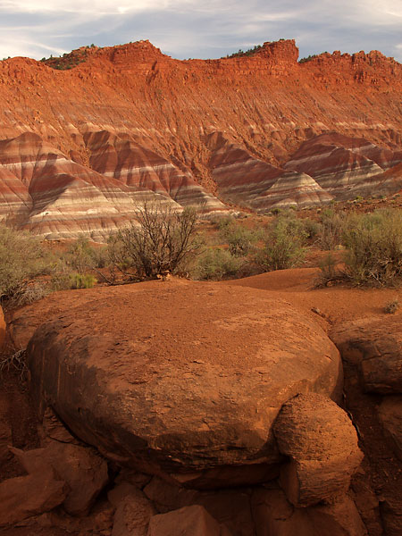
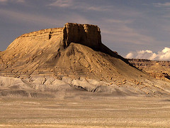
But that's not what was so interesting about the area. The valley itself was absoltely beautiful. Capped buttes watched over clay hills that reminded me of the Painted Hills in central Oregon, except most of the rock and clay here was bright red. The undulating terrain and color had excellent photographic potential and all seemed to face the west, so I marked this as a definite evening location. And just as perfect, I had the entire place to myself -- it was absolutely silent except for the faint sounds of nature. Here was the solitude I sought.

But there were even more amazing landscapes ahead in Grand Staircase. After exploring the area around the Paria River on foot, I went back to the highway and continued east to Cottonwood Canyon Road. It runs north through the heart of western Grand Staircase to near the southern tip of Bryce Canyon. This would be a chance for me to see what this part of the Monument really had to offer, and I still had plenty of midday light to kill.

Mesa at Cottonwood Canyon (Snapshot) 
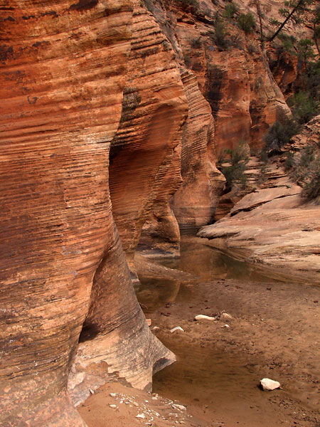
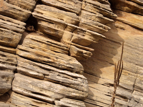
Cottonwood Canyon didn't let me down. The road itself was is decent shape for the most part, but it was little more than a plowed and somewhat graded strip of clay through the landscape. And while a long string of high voltage lines paralleled the road and occasionally interfered with the scenery, the drive itself was fantastic. Every few miles the terrain changed completely, exotic landforms protruding from the earth in all shapes and colors. I snapped numerous photos to at least record the area, but for every interesting landform I captured there were two or three I did not.

Formation at Cottonwood Canyon (Snapshot)Formation at Cottonwood Canyon (Snapshot)Formation at Cottonwood Canyon (Snapshot)


The entire drive would be an excellent place to photograph for sunset, but I knew had time to spend either here or in Paria, and after some deliberation I chose Paria. I mentally marked this as a place to return should time and weather allow, but unfortuantely neither did. By the time I drove to the Grovesnor Arch trailhead on the northern reaches of the road, I had just enough time to drive back to Paria before for good evening.

I arrived back at Paria to find I was right about the light, but wrong about the angle. The evening sun shone dead straight on the rippling landscape, and without shadows to give them depth, the photos were flat and two-dimensional. And to top it all off, there were clouds moving in low on the western horizon -- the storm they'd predicted was on its way. I moved father north to put some angle between me and the sun, and just as I'd found a few suitable shots, the sun sank behind the cloud bank. Frustrated and disappointed, I left my camera set up and explored the area on foot.

Mesa and Hills at Paria Then, just as quickly as it had disappeared, the sun beamed through a break in the clouds, and I ran back to my camera to grab what shots I could. For the next half hour I composed a shot then waited for the brief moments the sun would peak through the clouds. I managed to grab a handful of images, then the sun was gone for good.

Mesa and Hills at PariaRock Formation and Hills at PariaMesa and Hills at Paria

Southwest Utah, Part 2

Day 4 (Monday): A Reminder of Winter

No early rise today, as thin white clouds had rolled in. While dark clouds are great for photography, bringing out colors and blocking enough light for slower shutter speeds, these were rather useless. They left the land pretty still too bright, yet were white enough landscape shots were out. And with such bright white conditions, the colors in the plants and rocks were washed out as if it were a midday sun.

Resolved to exploring again, I hit the lesser traveled part of the park along the Kolob Resevoir Road. This road travels to the higher country in the west, cutting in and out of the park before passing through to the resevoir on the other side. There are occasionally rock formations and cliffs, but mostly it's desert highlands with vast sweeping views to the horizon. I was surprised by great stands of aspen along the road, very different from the cottonwood in the valley. This must be a spectacular place if the fall, but winter still helds its grip here and all the white trunks were still leafless.

Numerous trails that start in the area, as most of the western half of the park is backcountry. Hikers gearing up for their treks and the silent terrain gave me the urge to hit the trail myself, and I vowed to spend at least one day traveling by foot instead of by car. But not today, I had exploring to do.

I made a quick stop at Lava Point, the only major park area on the road. Not much this time of year, as the campground was closed and there was snow on the road, but a nice viewpoint overlooked a distant Zion Canyon. Once again, I had the whole place to myself. Despite my first experience a few days ago, solitude had not been difficult to find so far.

Kolob Resevoir, Spring (Snapshot) I drove on to the resevoir and was surprised to find it still mostly frozen. I had hoped to continue by backroad to Cedar City then on to Cedar Breaks National Monument, but snow blocked the road about two-thirds of the way. That meant a drive back to Hurricane, then up to Cedar City and across to the Monument. That would take time, but time I had. And I would pass Kolob Canyons, the last drivable area of the park.

I wasn't sure what to expect at Kolob Canyons. The name sounded promising, but being a road just off the Interstate, I wasn't sure about crowds. The visitor center was small and unassuming, and you can't see anything but desert scrub from there, but turning the first corner on the scenic drive my only thought was Wow! The entire road is dramatic views of sandstone mesas and valleys between them. There were at least two classic photos here I must have seen before. The photographic potential was amazing, but unfortunately it exactly the wrong lighting conditions. I snapped some shots for documentation just in case I never made it back, but this place was now the top of my list for sunset shots.

Summit Sign, with Bullet Hole (Snapshot) I continued north to Cedar City, then across on State Road 14 toward Cedar Breaks. The drive itself is quite pretty but seemed to go on forever, and winter was definitely still in charge. The road climbed and the snow deepened and I wondered if I was ever going to get there, then finally I crested the summit of the pass -- 9910 feet. I had no idea the elevation was so high, so I was not at all surprised when I got to Cedar Breaks and it was closed. Aside from the discovery of Kolob Canyons, the entire drive was for nothing.

Arch and Cottonwood There would be no sunset photos today as the clouds still held reign, so I drove back down to Zion Canyon via Hurricane to attempt some overcastshots. I ended up at the Temple of Sinawava since it was the darkest area, particuarly after the sun sank below the canyon rim. I tried photos of the contrasting green of the budding cottonwood trees and the red and purple cliff walls, but was unsure if they would amount to anything in this light. I also took some token photos of the Virgin River, but the muddy brown water was a far cry from what I was used to in the clear rivers of Washington.

Ridge and Cottonwood


Day 5 (Tuesday): Footfall

Another day of clouds, so another morning of sunrise photos lost, and today with a brisk wind. The clouds were thicker and darker as the meat of the storm passed overhead, so I did what I would do if I were back home in similar conditions -- rivers and color.

Virgin River My first stop was a scene on the Virgin River near Canyon Junction that I'd tried to shoot previously, but the thin clouds left too much sun. There was a perfectly placed cottonwood across the river, with a red cliff backdrop that really jumped out at me. But just as I'd set up my tripod and composed my shot, sunlight bathed down on the scene. There wasn't a cloud in the sky! What the hell?! I cursed the Utah weathermen for being as clueless as the Washington weathermen and gathered up my gear. Then just as I crested the embankment back to the road, the sun was gone again. Well hell! Back down to the river!

It seemed the sun really was gone this time, so I spent the rest of the day hiking the smaller trails in the canyon. First up was the Riverwalk Trail that started at the Temple of Sinawava. This is probably the most touristy hike in the whole park, so I wasn't surprised to be walking with dozens of other people despite the darkening weather. Other than the crowds, it was a nice leisurely hike along the river but the photo opportunities were limited since most of the trees were still budding and the sky was gray. The weather was too chancey to hike beyond the end of the canyon to The Narrows, even though I really wanted to see it.

Rocks and Pool There was one spot along the trail where water had collected in a pool below an arch in the cliff face, and the fallen rocks had stacked themselves into an interesting little structure. The pool was rimmed with green vegetation that really stood out in the overcast conditions. It was a very surreal scene, seemingly out of place on such a maintained trail. I almost expected a small hobbit or elf to come bounding out from between the rocks.

Arch, Rocks and Pool Cascade on Virgin River


After the short two miles of the river walk I hadn't quite fulfilled my hiking need, so I hiked the Emerald Pools as well. The weather was growing worse, with thicker rain and stiffer winds, but I pressed on nonetheless. The hike to the lower pool was rather easy, but other than the interesting walkway built into the cliff face, the pool itself was disappointing. The hike to the upper pool was much steeper, the stone steps seeming to never end. But the views across the valley and of the tower cliff face ahead made for enjoyable rest stops.

Upper Emerald Pool Finally I reached the upper pool and was again disappointed at the lack of color. The entire place -- rock and water -- was brown. I guess that's to be expected in the desert in March, but the name seemed rather deceptive. Some of the rocks along the water's edge were interesting and I'd just started shooting them when I got pelted by ice. The rain had turned to sleet and the wind was blowing it straight down the cliff face at me, enough for it to sting. That was my queue to leave.

The Watchman and Virgin River As the end of the day neared, the clouds cleared to the south and the evening light streamed down upon the landscape. I rushed down to Canyon Junction to shoot The Watchman, a scene I'd had my eye on since the first day in the park. I wasn't sure if it was allowed, but I set my tripod up on the narrow walkway on the bridge over the ricer and photographed it flowing past cottonwood trees, The Watchman towering over all. I found out later this is considered one of the best views in the park, and is apparently one of the most photographed. Later in the eek I saw literaly scores of people in this same spot, but for today I shared it with only a few others.

I made one final pass along the canyon as the sun peaked between breaks in the clouds, and managed to catch The Great White Throne. Not a bad ending to the day.

The Great White Throne


Day 6 (Wednesday): The Storm Drags On...

By now I'm getting frustrated. I get my third day of clouds as the storm stalls over the area, and another morning of photos lost. It could be worse, though -- the leading edge o the storm caused massive floods in Texas and a line of tornados in the Midwest extending for several states. But still...damn.

Grafton Heritage Site (Snapshot) I spent another day exploring, heading east again. First stop was the Grafton Heritage Site, just south of the town of Rockville. It's the remains of a turn of the century Mormon village that's been preserved as a historic site. It had a few old buildings and the obligatory cemetary, but didn't fulfill my conjured images of a ghost town. The buildings were too well preserved! Where's the delapidation?

Coral Pink Sand Dune (Snapshot) Next was a place I'd intended to visit a few days before when I'd ventured east but had passed it by -- Coral Pink Sand Dunes State Park. With a name like that, how could I not visit? The dunes were more orange than pink to my colorblind eyes, but they were definitely interesting. This would be a good place to shoot given the right light, but that was a scarce commodity on the trip so far, so I doubted I'd be back this time. I took snapshots from the access points along the road, and even ventured onto the nearest dunes at a few points, but refrained from visiting the main area and thus paying the access fee.

Weathered Cliff Face and Plant Onward to Grand Staircase again, this time to Johnson Canyon Road that ran along its western edge. Not as many interesting landforms as Cottonwood Canyon, but it had its share of cliffs. There was also a real ghost town called Windmill that matched what I imagined a ghost town would look like, but it was fenced off on private property. The weather along this drive was psychotic, at one point snowing and sunny at the same time. But the sun breaks as the day waned made for good light when a subject presented itself.

Weathered Cliff Face and Plant


I spent the end of the day looping back to Zion and shooting what I could along the upper road, among the cliff faces and interesting rock patterns. It continued to snow off and on and I had to stop at one point because the snow was so thick in the air I couldn't see my subject, but then once again the sky cleared and I was left with a dusk sky to grab a last few shots.

Southwest Utah, Part 3

Day 7 (Thursday): ...And On

Cloudy again! The weather forecast changed 180 degrees overnight. I went to bed with predictions of sunny skies all day, and a mere six hours later the forecast is clouds, clouds, clouds. Bah! My frustration had hit its limit by now, and I seriously contemplated just going home early. But one location tied me here still -- Kolob Canyons. I had to at least try to capture the beauty of that place, and that meant staying. Patience, grasshopper. So I resigned to make the best of what I was given, which was yet more time to explore.

I headed east again, unsure of my real destiation, and in the upper canyon the clouds were thick enough the light was managable. I photographed several different formations that had caught my eye in the previous days.

Pine Tree and Cliff FaceStriated Rock and ShrubRock Patterns and ShrubArch and Dead Tree


I also discovered a small canyon sunken below the road. I'd only managed a handful of photos before the thin clouds broke -- as they seemed to do during midday -- and the sun poked through, washing out the scene. I forged ahead anyway, exploring up the small canyon and shooting when the sun went behind a stray cloud.

Shallow CanyonCanyon Wall and PoolCanyon Wall and Pool


I headed east again and after looking at the map decided to dip into Arizona to visit Pipe Springs National Monument. The country is wide open down there, being desert highlands like the eastern part of Zion. I stopped in at the visitor center and talked a while with Paul in the gift shop, a fellow photographer. I decided not to visit the actual spring once I learned it was a simple watering hole. On the way back to Zion I happened to pass through Colorado City and Hildale, the two towns made famous by Warren Jeffs and the FLDS. I wasn't sure what to expect, but it looked a normal enough place on the outside.

On my way back, a thought occurred to me. This storm had to break some time, as it was very slowly moving eastward. We were under its most southwestern edge, so it could very well break today. The frequent sunbreaks pointed to the end. And if it did, there was only one place I wanted to be -- Kolob Canyons. It was a bit of a drive from Arizona, but the distance would put me there just about two hours before sunset, just the beginning of the best sunlight, assuming there was any sunlight to be had. The skies were already starting to clear in the south, and the clouds were moving fast with the winds. This was the time to take a chance and try to be at the right place at the right time. The Ansel Adams photo Clearing Winter Storm kept passing through my mind. That was what I hoped for.

My prospects weren't promising. The sky had cleated completely on the way up, until about two miles from the Kolob Canyons exit. A huge gray wall filled the sky and blanketed the entire area in shadow, as if protecting Kolob Canyons from photographers. Conditions at the canyons were not quite what I'd hoped. A bitter wind with 50 mph gusts tore through the valley, bringing occassional sleet and snow with it.

The sun occasionally broke through the fast moving clouds, just enough to keep my hopes up, and I chased them in "quick photo" mode. I didn't bother taking the camera off the tripod, balancing the legs, or even turning off the camera itself. The only way to have even a prayer of catching a shot was to speed to the location, place the tripod, compose and shoot. The wind made this even more difficult, at one point nearly ripping my tripod out of my hands and off the hillside in front of me. It was quite an adventure, and at one point I was literally laughing aloud as I flew from one place to another.

Then the sunbreaks stopped. I waited. And waited. Still the clouds were unrelenting. Now, I had a decision to make. I could stay here and wait it out, see if the clouds would eventaully break. Or I could drive back to the main canyon, burning half of the remaining daylight. The image of the wall of gray cloud and the clear blue sky to the south flashed through my mind, and I'd made my choice.

I put the car in gear and let off the parking break, and at just that instant the storm literally broke above me. My decision, it seemed, had been made for me.

Nagunt Mesa I spent the next hour shooting what was one of the most beautiful scenes I have every been fortunate to witness. Sunlight poured through rifts in the clouds behind me, covering the peaks and cliffs in golden light. Behind them, the clouds of the clearing storm flowed passed in silent exit, leaving a fresh dusting of white snow. It was a magic combination -- towering mountains, a clearing storm, fresh snow and a golden sunset. It was easily one of the most beautiful things I have ever seen.

Canyon on South Fork Taylor CreekShuntavi PointShuntavi PointSuntavi Point and Stapley PointNagunt Mesa ValleyTimber Top MountainTimber Top Mountain and Shuntavi Point


Day 8 (Friday): Comedown

I finally got the sunny morning I'd wanted, and I spent it in the canyon shoot places I just didn't have the light for previously. Today was a bonus day, much more relaxed than before. Any photos I took today were gravy, because I couldn't imagine topping what I had seen at Kolob Canyons.

Streaked Wall The SentinelAngels Rest


I spent the morning in Zion Canyon again, focusing on areas I'd missed before becase I just didn't ahve the light, primarily on a few silhouettes I'd had my eye on all week. Midday was spent back at the hotel, packing up for the journey home. And for evening, I ventured around the main park roads just seeing what grabbed my attention. Relaxed, contented, fulfilled.

Observation Point SilhouetteThe Pulpit SilhouetteSilhouette on Cathedral Mountain


Day 9 (Saturday): Long Drive Home

I made the drive home in a single day, 1100 miles in just under 17 hours. Thank the gods for cruise control. And thank Utah and Idaho once again for their 75 mph speed limits.

I managed again to pass through Oregon without stopping for gas. They need to get with the program with that 65 mph business too. Eastern Oregon is much to vast for that nonsense. Clouds met me at the Oregon border and it was raining by the time I reached the Blue Mountains, washing off my proudly won Utah dirt. Welcome back to the Pacific Northwest.

It was an extremely long drive, distance is measured in hours and meals are determined by the gas tank. Crossing into Washington was the hardest part. I was almost home, or so it seemed, yet there were still hours to go. My muscles were tired and my joints stiff. I was tired of all my music, and the mile markers ticked by oh so slowly. But finally a recognizable landmark, Snoqualmie Pass. A little farther. North Bend. Then finally, Bellevue. For the first time in almost 17 hours, I leave the Interstate. Then I'm in my neighborhood, on my street, in my driveway. Home.

Soon enough I'll wish I was out there again, but for now it's good to be home.