I ended up on Skate Creek Road (FS-52) in Gifford Pinchot National Forest. It's a pretty major thoroughfare down to Highway 12, but I've never seen it so desolate. I saw almost no one there at all. It's a nice drive along the creek, and I stopped at one place to investigate a waterfall on the opposite side. A footpath lead down the steep slope to the creek side, but the underbrush got thick and thorny very quickly. I considered bushwhacking father, and even started chopping through with my makeshift walking stick, but it wasn't good enough for that much effort. I made a little side trip up Butter Creek (FS-5270), based on vague memories of the creeks from the last time I was there, but the winter floods had carved deep trenches in the road and I had to turn around just after the main creek crossing.
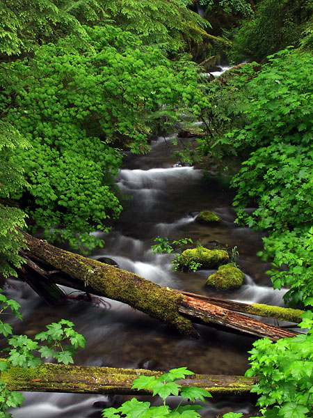 I wandered next down to Johnson Creek Road (FS-21), across Highway 12. I'd been here before, but I only remembered the creek crossing near the snow park, so everything south of there was new to me. The Glacier Creek crossing was very photogenic, so I stopped there to shoot a while. I wanted to follow an offshoot (FS-2115) farther down the creek, but blowdowns blocked the way. Walking the road showed it was indeed very photogenic, but I couldn't find a safe way down to the creek. The map showed a trail (#89) that follows the creek up to Glacier Lake, but I didn't have my hiking gear with me so it would have to wait. It's definitely on my list now.
I followed several small offshoot roads that either went nowhere or were blocked by blowdowns or washouts. One lead to a nice solitary camping spot on a cliff face overlooking the valley. That would be a nice place to camp. The road along Deception Creek (FS-2130) was longer and looked promising, but turned out to be the same. I crossed several washout areas that were rather dicey, but ultimately had to turn around at a major washout on the first creek after the big bend. I had hoped that the road crossing upstream on Deception Creek would be a decent shot, but now there was no way to reach it. Without a trail or other destination on this road, I wonder if they will ever fix it.
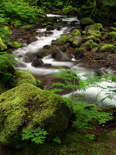
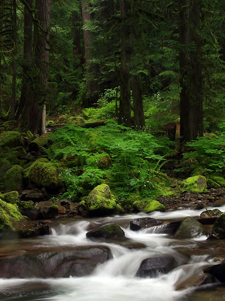
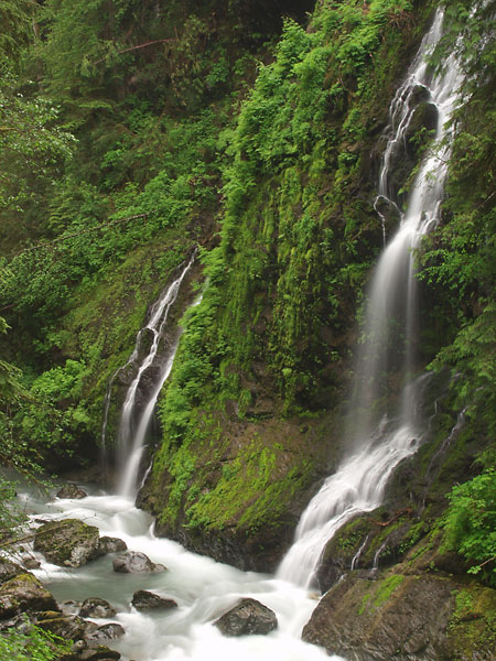
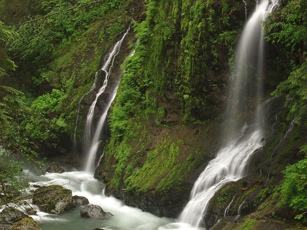
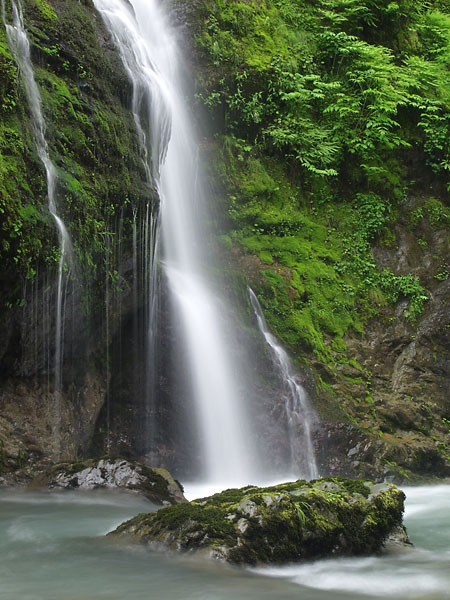
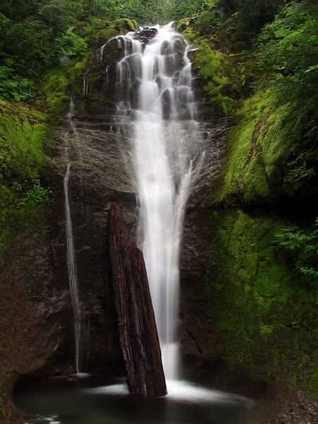 Then I dropped down into the North Fork Cispus River area following FS-22, a nice winding road down the valley. None of this looked familiar at all, although I remembered the far western section. The St. John and St. Michael creek crossings were decent but not photoworthy, but the creeks coming off Horseshoe Point were another matter. The first waterfall reminded me of one I'd seen at Rainier. It was about twenty feet tall and there was a strategically placed piece of wood at the base of the fall. I wanted to shoot up the creek, but there was a large and unattractive pile of debris just down from the base, so I had to hike up the creek to shoot over it. Shooting up in the light rain proved a little difficult, but I did manage to keep the lens dry enough for a few shots. There was another waterfall at the next creek crossing, but my batteries were running low and I decided to just take a few snapshots to record it. It would be difficult to shoot with the vegetation and debris, and as this was more exposed, the wind was blow the falling water right into the lens.
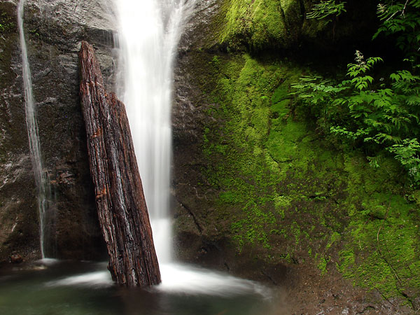
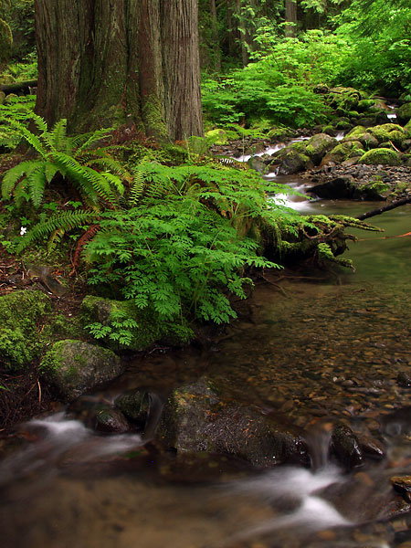
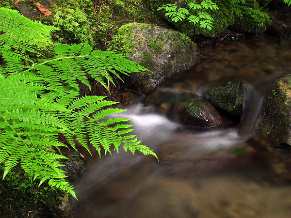
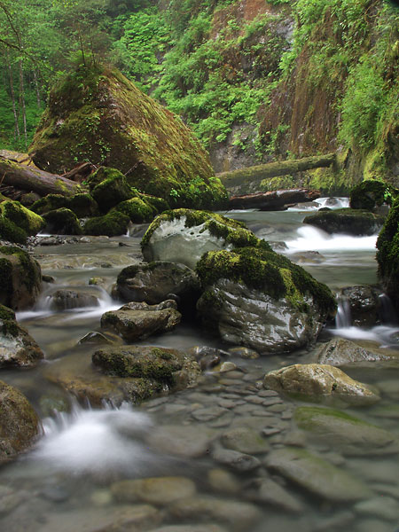
My last stop of the day was at Timonium Creek on a spur road (FS-2208) following back up the North Fork Cispus River on the other side. I had been here before and hadn't shot for some reason. The rain was steady and my batteries low, but I wanted to give it a show anyway. There are potentially several shots there that I can see, but without a better zoom or a telephoto, I can't shoot them from the bridge. I pushed through the vegetation to the creek edge, but it was so thick I couldn't find a view of the shots I wanted. I tried both upstream and downstream, and even hiking down to where it met the Cispus, but I just couldn't find the right locations. Frustrated and lenses fogged, I gave up and went back to the car. Next time, I will get you next time.
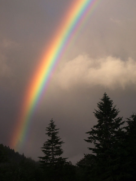 The rain broke on the way home, and the setting sun gleamed through the clouds. I had visions of a dramatic clearing storm on Rainier, similar to what I'd seen at Kolob Canyons in Zion, but what I got was a rainbow -- one of the most brilliant rainbows I'd ever seen. The colors were so bright it almost hurt my eyes. I stopped at an empty field with a distant barn and setup my gear, composing as fast as I could (also reminiscent of Kolob Canyons), but I grabbed a couple of shots before it was gone. Disappointed, I kept driving and watched the increasing sunbreaks for a second chance. Instead of turning left at Elbe, I turned right toward Rainier and had barely made it out through town when another rainbow appeared. I found as good a places as I could to shoot, using a couple of trees as silhouettes, and managed to get off a dozen shots before it faded.
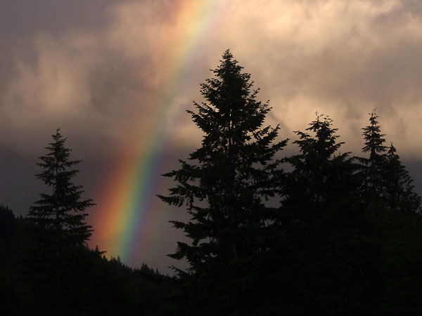
An interesting thing I learned today: you can completely remove a rainbow from a photograph by rotating the polarizer to the right spot. Makes sense, but I had no idea.