November 17, 2006

MRNP Flood Damage

Not to keep harping on this but the flood damage is so devastating, particularly at Mount Rainier National Park. This has already become the wettest November on record for Seattle, and is very close to becoming the wettest of any month at all. And there's more storms coming.

These photos are from the National Park Service for MRNP. I am very glad that I spent so much time there this fall, because it may be a year before some of these roads are open again.

Eastside Road (SR-123):

Eastside Road Washout
Eastside Road Landslide


Grove of the Patriarchs:

Suspension Bridge Damage
Damaged Boardwalk in Mud


Ohanapecosh:

Destroyed Picnic Table in Ohanapecosh Campground
Logjam on Ohanapecosh River


Carbon River:

Carbon River Road Washout
Ipsut Cabin Washout
Ipsut Cabin in Mud


Nisqually:

Longmire Road Washout
Longmire Road at Former Site of Sunshine Point Campground
Longmire Road Washout


SR-410:

Flooding on SR-410
Flooding and Downed Trees on SR-410

November 15, 2006

More Flood Damage

More photos from the flood damage of the last week. Again, I do not take credit for any of these photos.

Grove of the Patriarchs, MRNP (from Mount Rainier Climbing and Pütz-in-Boots @ NWHikers):

Interpretive Sign in MudDamaged Suspension Bridge


Carbon River Road, MRNP - 2 miles of road washed away (from Tazz @ NWHikers):

Carbon River Road Washout


Index, WA (from andrew e @ NWHikers):

Index-Galena Road Washout


FS-74 / West Fork White River, MBSNF (from Justan @ NWHikers):

FS-74 Washout


Suiattle River Road, MBSNF (from Quark @ NWHikers):

Suiattle River Road, First Washout
Suiattle River Road, Second Washout

November 07, 2006

Floodwaters

When I was watching the high water levels last weekend, I had no idea what was in store for the area. Western Washington has been in what could be 100 year floods. Almost every major road into the mountains is closed from flooding, possibly permanently. Most of the major rivers are at or beyond record heights. Entire towns have been evacuated and are under water. The Sunshine Point Campground at Mount Rainier National Park has completely washed away -- it is no more -- along with a quarter mile of the Longmore Road. The power of Nature is simply incredible.

The following are selected photos from the floods. I did not take these pictures, and do not take credit for them in any way.

Deception Falls NRA (from Alpine Andy @ WTA):

Footbridge Over Deception Creek Flood
Deception Creek Flood


Snoqualmie Falls (from MtnDog @ NWHikers):

Snoqualmie Falls at Flood Levels


Mount Rainier National Park (from Mount Rainier Climbing):

Longmire Road Washout
Longmire Road Flooding
Westside Road Flooding


Stillaguamish River (from JimK @ NWHikers):

Stillaguamish River Flood


Fall City, WA (from MtnDog @ NWHikers):

Snoqualmie River Flood


Snohomish River (from Pütz-in-Boots @ NWHikers):

Snohomish River Flood


Middle Fork Snoqualmie River (from Tom @ NWHikers):

MFK Snoqualmie Flood


Granite Falls, WA (from naturalbeing @ NWHikers):

Granite Falls Fish Ladder Flooding


Eagle Falls (from Seattle Times):

Eagle Falls Flooding


North Fork Skykomish River (from kleet @ NWHikers):

NFK Skykomish River Flooding


Nooksack River (from Bellingham Herald):

Nooksack River Flooding at I-5


Cowlitz River (from grizzly86 @ NWHikers):

House Floating Down a Flooded Cowlitz River

November 04, 2006

When It Rains

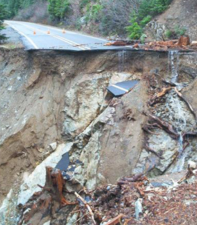
Despite the predicted wind and heavy rain, I decided to retrace my steps from last weekend. There were several places I wasn't able to shoot because of fading light or falling snow, and I didn't think I'd get too many more weekends this year to attempt them.

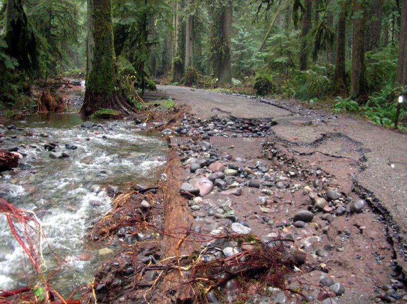
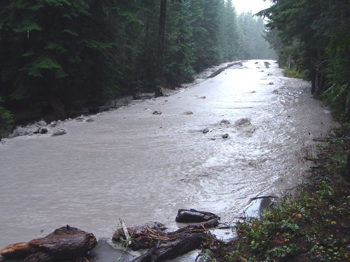
The drive along the Index-Galena Road was a precursor of what was in store for the day. The prevalent maple leaves scattered on the ground that were so beautiful and yellow last weekend were now dingy brown and soaking wet, and the rivers and creeks were running much higher thanks to the rain we've had this week.

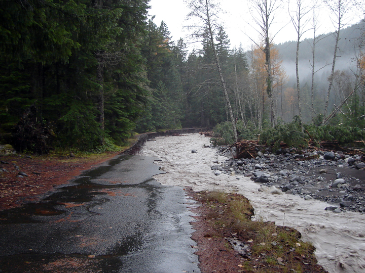
I made it to the Quartz Creek trailhead despite the quarter inch of snow on the road and quickly saw that the primary photos I was after for the day were impossible. What had been a majestic and graceful cascade on the North Fork Skykomish River was now a raging torrent.

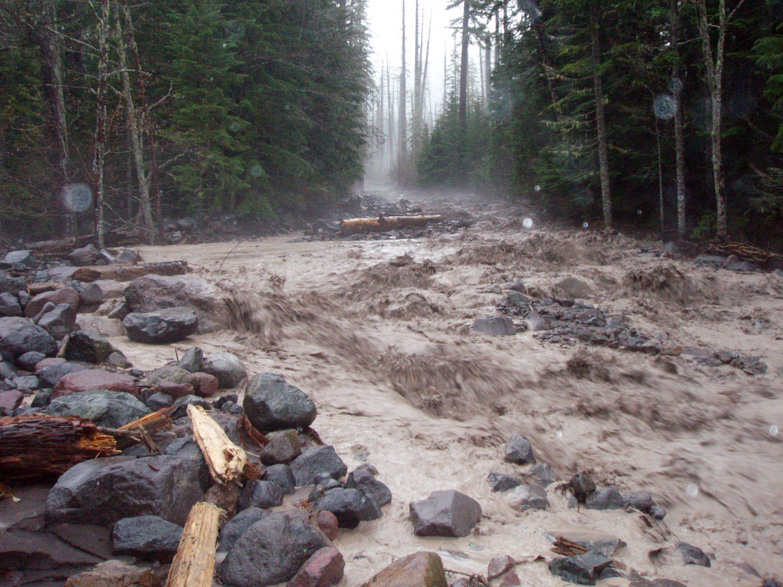
I again drove up and over Jack Pass down into the Beckler River valley, the frozen rain replaced this time with a driving downpour. All the tiny runoff streams were full and even the normally dry creek beds were running. Places like Fourth of July Creek had filled or were overflowing their banks and looked nothing like they had the previous weeks.

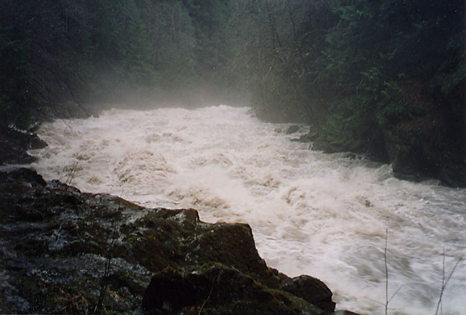
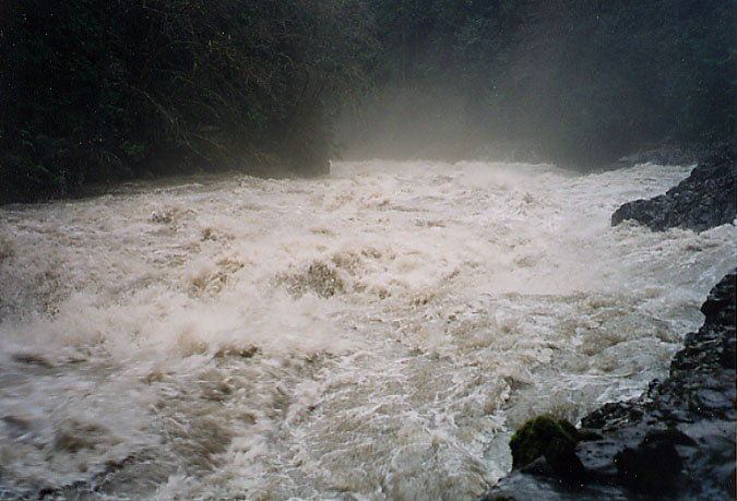
The small stream covered with maple leaves that I'd photographed last week was much less photogenic this time, so I drove back up Rapid River Road to see how the cascade at the end looked in this weather. I certainly didn't expect it to look anything like last time. The fresh and falling snow on such a majestic waterfall was certainly not to be repeated this time, and I was right. I tromped around in the forest, looking for the canyon I'd heard about, until I was too wet and cold and had to turn back.

That was it for the day, there was nothing left to see. The weather was too ugly and the water too high for me to get the camera out even once.incredible.